

 © Pete Saloutos/Panoramic Images (Washington Title Image Large)
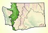
Puget Trough Landforms
The Puget Trough ecoregion is a geologically young land still recovering from the comings and goings of Pleistocene glaciers. The last glacier receded northward about 10,000 years ago.
The Puget Lobe of the continental ice sheet depressed the region under ice nearly a mile thick. Puget Sound itself was scoured out by glacial action. Its deep north-south channels and basins are the glacier’s legacy.
The hills of Seattle and Tacoma are north-south trending drumlins, or hills of glacial debris. Elevation in the Puget Trough ecoregion averages 450 feet, but ranges from sea level to about 2000 feet.
Several large rivers drain into Puget Sound, among them the Skagit, Stillaguamish, Snohomish, and Nisqually. Rivers and streams formed valleys with rich bottomland and productive deltas. They bring fresh water into the marine environment. The Skagit River is the greatest single source of freshwater to the Sound.
South of Puget Sound, near present-day Fort Lewis and Olympia, outwash from the glacier produced fast draining and gravelly soils. These soils gave rise to Mima Mounds and prairie vegetation.
Further south, near Kalama, Kelso, and Vancouver, river deposits formed the soils. Ice age floods of the Columbia River left behind deep silts.
For details of this ecoregion within Washington, click a subheading in the left column.
View the more general description of this ecoregion in North America
Go to the Map

Use the interactive map to zoom smoothly from a national view to state and local perspectives anywhere across the country.