

Contribute Data
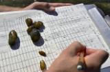
© Jack Looney Contribute Data Featured Image
LandScope America brings together data from many sources and makes them freely accessible to visitors through any browser. By providing access to this material without the need for dedicated GIS software or skills, the project represents another step in the democratization of geospatial data.
In practice, the content available on our map viewer is closely curated and administered. We publish or, in most cases, republish datasets, and information from partners and collaborators. While using the map viewer, you can identify our data sources through the related content panel that consistently appears along the right edge of your screen. If you have specific questions, concerns, or comments about individual datasets, they are best channeled through these data providers.
On the other hand, we'd welcome your comments, questions, and suggestions about the map viewer or data that might be relevant and appropriate for LandScope America, please contact us!
Share Your Data with Our Partners
-
Data Basin
Data Basin is a global online data-sharing tool developed by Conservation Biology Institute that allows users to view and explore biological datasets, upload or download data, produce and share customized maps, charts and tables, evaluate content, and connect with experts.
Go to the Map

Use the interactive map to zoom smoothly from a national view to state and local perspectives anywhere across the country.
Go Straight to Your State
Learn about conservation and open space in your state.
Contribute to LandScope

Want to join, work with us or simply find out more? Learn how you can get involved.
