

 © Steve Vaughn/Panoramic Images (Florida Title Image Large)
Significant Surface Waters
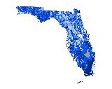
This data layer was created by FNAI, in consultation with state water resource experts, as part of the Florida Forever Conservation Needs Assessment, a statewide analysis of natural resource conservation priorities for the Florida Forever statewide environmental land acquisition program. This data layer highlights areas that have statewide significance for land acquisition to protect surface waters with good water quality and those that are currently in a relatively natural condition. It is not intended to address those surface waters with substantial restoration needs.
The Significant Surface Waters model is a combination of a eight water resource submodels: Special Outstanding Florida Water (OFW) rivers as defined by DEP, other OFWs (on conservation lands), OFW lakes and Aquatic Preserves, coastal surface waters, the Florida Keys, springs, rare fish basins, and water supply sources. For each resource category, drainage basins that contributed to the resource were selected and buffers were applied to all water bodies.

More Information
Relevance to LandScope:
The Significant Surface Waters is a primary water resource data layer used for statewide and regional conservation planning in Florida. It informs the priorities of the Florida Forever conservation land acquisition program and the Critical Lands and Waters Identification Project (CLIP). If this data layer is present on a site, it indicates that the location appears to be in the vicinity of a surface water feature that has statewide significance. The location likely contributes water runoff to significant surface waters. The higher the priority class, the closer the site is to the significant surface water.
How to get more information:
For a detailed description of methods, please refer to: Conservation Needs Assessment Technical Report
For an overview of the Conservation Needs Assessment, please refer to: Conservation Needs Assessment Summary Report – December 2000
Available at FNAI's Florida Forever page
How to get the data layer:
To download the GIS data layer, please refer to: Florida Forever Conservation Needs Assessment Data Layers, Version 3.0
Go to the Map

Use the interactive map to zoom smoothly from a national view to state and local perspectives anywhere across the country.

