

 © Pete Saloutos/Panoramic Images (Maine Title Image Large)
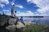
The Lower Kennebec Estuary
© Heather Perry Burke0705.013
Downstream from Merrymeeting Bay, the Lower Kennebec Estuary runs for another 15 miles between forested uplands and rocky shorelines, across mudflats and through salt marshes.
Deep water and strong currents support an abundant food web and habitat for recovering populations of migratory fish, including Atlantic salmon, striped bass, alewife, shad, herring, and sturgeon. All twelve species of migratory fish currently found in Maine live here, and every native fish species was once found in the river. The high salt content and significant tidal changes in prevent much of the Lower Kennebec from freezing, providing critical habitat for over-wintering bird species.
Explore the Lower Kennebec Estuary
-

© Heather Perry (MMB_005)
Back River and Hockomock Bay
by Beginning with Habitat
Marshes along the Sasanoa and Back Rivers make up one of the largest brackish tidal marsh systems in Maine. -

© Heather Perry (DSC_0003)
Pleasant Cove, Woolwich
by Beginning with Habitat
Five rare species have been found in moderate to high abundance along the eastern shore of Pleasant Cove. -

© Margaret Pizer (Maine_TNC_Basin_kayak)
The Basin Preserve
by Beginning with Habitat
The largest protected area in the Kennebec Estuary, the Basin Preserve features a diverse topography that ranges from hemlock gorges and pitch pine ridges to over four miles of shoreline popular with boaters. -
Newtown and Minot Creeks and Tarrs Mountain, Arrowsic
by Beginning with Habitat
The approximately 200 acres of salt marshes of Newtown Creek and Minot Creek along both sides of Tarrs Mountain host intact diverse habitats near protected land. -
Preble Point, Arrowsic
by Beginning with Habitat
Surrounded by tidal marsh dominated by saltmarsh cordgrass and softstem bulrush, Preble Point is the state's only known location for the marsh bulrush, a hybrid of river bulrush and salt-marsh bulrush.
Go to the Map

Use the interactive map to zoom smoothly from a national view to state and local perspectives anywhere across the country.

