

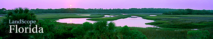
 © Steve Vaughn/Panoramic Images (Florida Title Image Large)
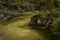
Apalachicola River Basin

© Rob Sheppard Apalachicola River Basin Featured Image
The Apalachicola River basin is a geographic area in the Florida Panhandle that drains a watershed of some 20,000 square miles. The northern reaches of this basin include a dramatic landscape of steep bluffs and deep ravines, making these some of the most significant natural features of the southeastern Coastal Plain. The river and its surrounding forests, prairies, and coastal habitats are recognized as one of six biodiversity hotspots in the United States. This complex river ecosystem supports more than 1,500 species of native plants and animals, as well as numerous endemic species that exist only in this region. The river basin has the highest species diversity of reptiles and amphibians in the U.S. and Canada, with more than 40 species of amphibians and 80 species of reptiles. The Apalachicola National Forest, which borders the river, is one of the largest contiguous blocks of public lands east of the Mississippi River.
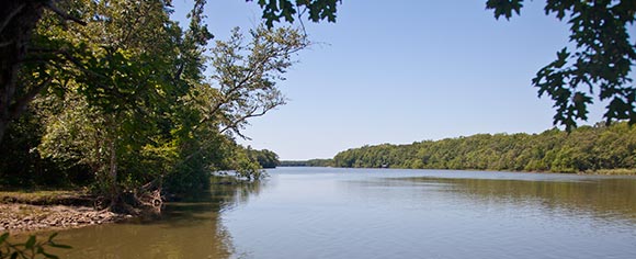
Fed by the Chattahoochee and Flint Rivers, the 107-mile-long Apalachicola River has the largest volume of water flow in Florida. It ranks as the 21st largest river in the U.S. and the fifth largest river entering the Gulf of Mexico. Regarded as one of the most productive estuarine systems in the Northern Hemisphere, Apalachicola Bay is a National Estuarine Research Reserve. The bay is designated an International Biosphere Reserve by UNESCO, the United Nations Educational, Scientific and Cultural Organization, and is recognized as an Outstanding Florida Water by the Florida Department of Environmental Protection. The bay also supports one of the country’s most productive fisheries, accounting for 13 percent of the nation’s oysters and more than 50 percent of Florida’s oyster catch.
Explore the Apalachicola River Ecosystem
An ancient coastal shoreline, near river mile 78, serves as a natural divide between the upper and the lower reaches of the Apalachicola River.
Upper Apalachicola:
The upper Apalachicola River passes along Florida’s northern highlands, an area of relatively high topographic relief with rich soils. The river carved through these highlands over thousands of years, creating high bluffs along its eastern shore. Torreya State Park and The Nature Conservancy’s Apalachicola Bluffs and Ravines Preserve offer dramatic views of the river from atop these bluffs.
Punctuated by ravines and steepheads, these dissected highlands are forested with deciduous oak (Quercus spp.), hickory (Carya spp.), ash (Fraxinus spp.) and other tree species more akin to the Southern Appalachian Mountains than other parts of Florida. These forest trees are aglow each November in shades of orange, red and yellow before losing their leaves for the short winter. Beginning in late January, the forests come alive with dazzling displays of spring wildflowers such as trout lilies (Erythronium umbilicatum), bloodroot (Sanguinaria canadensis), trillium (Trillium spp.), rain lilies (Zephyranthes atamasca) and wild columbine (Aquilegia canadensis). Angus Gholson Nature Park, in the town of Chattahoochee, FL, and Torreya State Park are ideal places to enjoy the display of spring wildflowers.
Ecology 101 at ABRP
Observant hikers can gain a greater appreciation for this region’s natural beauty along the aptly named "Garden of Eden Trail" at The Nature Conservancy’s Apalachicola Bluffs and Ravines Preserve.
Lower Apalachicola:
A mosaic of habitats are scattered along the lower Apalachicola River, including vast expanses of pine flatwoods, wet prairies and cypress-tupelo swamps. This area harbors North America’s greatest concentration of carnivorous plant species and the largest stand of tupelo trees (Nyssa aquatica) in the world. Not surprisingly, the lower Apalachicola region is a haven for wildlife. The largest known populations of federally endangered red-cockaded woodpecker (Picoides borealis) and Florida black bear (Ursus americanus floridanus), a state-threatened species, occur here. This region also supports more than 150 rare plants and animals, of which 15 are listed as federally threatened or endangered.
Fortunately, the lower Apalachicola River includes one of the largest expanses of public conservation lands east of the Mississippi River. Apalachicola National Forest, Tate’s Hell State Forest, Apalachicola Wildlife and Environmental Area, and Apalachicola River Water Management Areas comprise nearly 900,000 acres of protected lands and waters. One of the easiest ways to see and explore this remarkable part of the Florida Panhandle is from the Apalachee Savannahs National Scenic Byway. From Bristol, FL, follow State Road 12 south to State Road 65 and continue southward from Sumatra, FL.
Learn more about the Apalachicola River Basin
The Nature Conservancy's web page: Apalachicola River, Florida Website
The Florida Department of Environmental Protection's webpage: Apalachicola National Estuarine Research Reserve Management Plan Website
The Florida Department of Environmental Protection's webpage: Apalachicola National Estuarine Research Reserve Website
Featured Stories
-
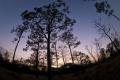
© Rob Sheppard (ABRP-in preserve-5)
Dam Removal Gives Kelley Branch Some Shiners
by Bruce Ritchie
Those involved with the restoration of Kelley Branch -- a stream created by groundwater seeping from the sides of steephead ravines west of Tallahassee -- say similar dam removal projects could restore aquatic habitat across the Southeast. -

© Rob Sheppard (Spark of Life Fire in Florida Featured Image)
Spark of Life: Fire in Florida
by Rob Sheppard
Naturalist Rob Sheppard argues that life in Florida entails a certain responsibility to recognize that fire is crucial to the essence of its unique and highly evolved ecosystems. -
© Rob Sheppard (ABRP-March08-27)
Ecology 101 at Apalachicola Bluffs and Ravines Preserve
by Rob Sheppard
A short walk along the Garden of Eden Trail at The Nature Conservancy's Apalachicola Bluffs and Ravines Preserve can quickly reveal what ecosystems are all about to any observant hiker.
Go to the Map

Use the interactive map to zoom smoothly from a national view to state and local perspectives anywhere across the country.
Go Straight to Your State
Learn about conservation and open space in your state.
Contribute to LandScope

Want to join, work with us or simply find out more? Learn how you can get involved.
