

 © Steve Vaughn/Panoramic Images (Florida Title Image Large)
Ecosystems 101
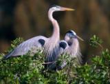
© David Moynahan Ecosystems 101 for Florida Image
Florida’s ecosystems, or communities of plants and animals, are described by various classification systems that differ depending on scale and purpose. For example, the classification system developed by A.W. Kuchler identifies only 10 vegetation types for the entire state, with most of the upland forests characterized as Southern Mixed Forest. At the other end of the spectrum, the National Vegetation Classification recognizes over 350 ecological Associations for Florida, making fine floristic and location distinctions such as Sand Pine / Florida Scrub Oak Woodland versus Sand Pine / Myrtle Oak - Sand Live Oak Woodland. The most commonly used ecosystem classification systems for Florida are described below.
FNAI Natural Community Classification
A Natural Community is defined as a distinct and recurring assemblage of populations of plants, animals, fungi and microorganisms naturally associated with each other and their physical environment. The FNAI classification recognizes 81 distinct natural community types, which are characterized by landform, substrate, soil moisture condition, climate, fire, and characteristic vegetation. This collective set of natural communities constitutes the original, natural biological associations of Florida.
The FNAI Natural Community classification is widely used in Florida. FNAI tracks the locations of high quality examples of natural communities in the state, information that is used by agencies and organizations such as the Florida Department of Environmental Protection and The Nature Conservancy for conservation planning and prioritization. In addition, state land managers use this system to identify the habitats on their lands and to guide land management practices.
Explore the Guide to the Natural Communities of Florida.
The Guide also provides crosswalk information between the FNAI system and other classifications. An update to the classification will be complete in July 2009.
The U.S. National Vegetation Classification (USNVC)
The USNVC is an ecological classification developed by NatureServe and its natural heritage member programs in partnership with the Federal Geographic Data Committee Vegetation Subcommittee (FGDC), the Ecological Society of America Vegetation Classification Panel (see Jennings et al. 2003)) and federal partners. The USNVC is a seven-level hierarchical system consisting of Physiognomic Classes at the highest level and floristic Associations at the finest level. Associations are determined by species composition, structure and habitat, and are considered elements of biodiversity.
Learn more about the USNVC through NatureServe Explorer
FWC Florida Vegetation and Land Cover
The FWC Florida Vegetation and Land Cover includes classes of vegetation and land cover types that were derived from 2003 Landsat ETM+ Imagery. The classification identifies 43 vegetation and land use classes-- 26 natural and semi-natural vegetation types, 16 types of disturbed lands (e.g., agriculture, urban, mining), and 1 water class. The FWC Florida Vegetation and Land Cover provides consistently mapped data for the state of Florida.
Read more about the FWC Vegetation and Land Cover or View the Map
Florida Land Use, Cover and Forms Classification System (FLUCCS)
The FLUCCS was developed by the Florida Department of Transportation to support land use planning. Although the traditional emphasis of the classification has been on land use, it does contain detailed categories for natural vegetation. The FLUCCS is a hierarchical scheme that is classified at four levels with increasing specificity. The classification is intended to support the classes of land use and land cover that can be extracted from aerial photography.
Florida’s five water management districts and most recently the Florida Department of Environmental Protection create a GIS Land Use Land Cover map for each water management district based on the FLUCCS classification.
Go to the Map

Use the interactive map to zoom smoothly from a national view to state and local perspectives anywhere across the country.
Go Straight to Your State
Learn about conservation and open space in your state.
Contribute to LandScope

Want to join, work with us or simply find out more? Learn how you can get involved.
