

 © Pete Saloutos/Panoramic Images (Maine Title Image Large)
TNC Ecoregional Priorities in Maine
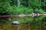
© Chee-Onn Leong TNC Ecoregional Priorities Featured Image
Ecoregional planning is one of two methods that The Nature Conservancy uses to establish its land protection priorities. By assessing relatively large geographic areas delineated by consistent climate, vegetation, geology and other ecological and environmental patterns, this process provides a regional-scale, biodiversity-based context for implementing on-the-ground conservation action. TNC currently identifies 67 terrestrial ecoregions in the conterminous 48 U.S. and another five and 11 ecoregions, respectively, in Hawaii and Alaska.
Each ecoregional planning process leads to the design of an ecoregional portfolio, which includes conservation areas representing the full distribution and diversity of native species, natural communities, and ecosystems both within and across ecoregions. If managed appropriately, a portfolio will ensure the long-term survival of all native life and natural communities, not just threatened species and communities.
By highlighting areas that the Conservancy believes are both most important and most suitable for the conservation of ecoregional biodiversity, these portfolios guide on-the-ground actions by the Conservancy and its public and private partners. Each portfolio includes terrestrial and freshwater priorities, as well as marine priorities for coastal ecoregions.
Every ecoregional assessment also identifies priorities that affect multiple conservation areas. These priorities include wide-ranging targets, pervasive critical threats, and institutions and mechanisms that affect multiple conservation areas within a given portfolio, among several portfolios or across geopolitical boundaries.
Designing ecoregion-based portfolios is a complex, iterative process based on five steps:
- Identifying the species, communities and ecosystems in an ecoregion;
- Setting specific goals for the number and distribution of these conservation targets to be captured in the portfolio;
- Assembling information and relevant data on the location and quality of conservation targets;
- Designing a network of conservation areas that most effectively meets the goals; and
- Identifying the highest priority conservation areas, wide-ranging targets and pervasive threats for conservation action.
Learn more >>
The Nature Conservancy’s process of setting priorities
http://www.nature.org/aboutus/howwework/cbd/science/art14308.html
Technical Guide
http://conserveonline.org/workspaces/cbdgateway/era/index_html
Library of Completed Assessments http://conserveonline.org/workspaces/cbdgateway/era/reports/index_html
Go Straight to Your State
Learn about conservation and open space in your state.


Contribute to LandScope

Want to join, work with us or simply find out more? Learn how you can get involved.
