

Share Your Photos

© David Moynahan DM_David&Spidr6481-J2
Join the LandScope photo community by submitting images for inclusion in the LandScope map viewer collection! By populating our conservation map with great photography, we hope to provide a variety of audiences with clear evidence of what makes America's natural places unique and worth conserving.
Submitting photos is free and photographers retain full copyrights to their images while receiving prominent credit. Photographer contact information will be accessible to viewers that might be interested in licensing your images for further conservation use. Photography is presented for information and inspiration purposes only.
While our long-term goal is to enable you to share your photos directly through LandScope, we'll be using a more curated approach in the project's early phase. Your submissions should contain a minimum of five photos, but we welcome as many photos as you would like to submit.
Read on to learn more, and when you're ready, Contact Us. When using the contact form, be sure to select "Contribute Images" as the message subject from the drop-down list.
Ideal Photo Subjects
Photos can be of anywhere in the United States! During our beta phase, we are especially interested in images from our pilot states of Colorado, Florida, Maine, Virginia, and Washington. Subjects include:
- landscapes of any type or season
- wildlife and birds
- plants, wildflowers, insects, and backyard habitat
- landscapes with animals, people, houses, vehicles
- people hiking, biking, camping, bird-watching
- environmental threats and the contrasts and conflicts between the human and natural worlds
- maps, GPS units, binoculars, cameras, water bottles, and backpacks
- people studying the natural world
Learn More
-

© Charlie Johnson (CJ_CO_NGLandScope_41 copy)
Image Specifications
It's important that our photo contributors write the appropriate metadata into their digital files. Following these guidelines will prepare your photos to display properly on LandScope.
-
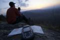
© Jack Looney (NW4S5191)
Geotagging Photos
If your camera doesn't automatically insert GPS coordinates into your digital files, there are a few ways to tag your photos manually.
Go to the Map

Use the interactive map to zoom smoothly from a national view to state and local perspectives anywhere across the country.
Go Straight to Your State
Learn about conservation and open space in your state.
Receive Email Updates

Stay up to date with the latest at LandScope America by entering your email below.
Contribute to LandScope

Want to join, work with us or simply find out more? Learn how you can get involved.
