

 © Mike Norton (Colorado)
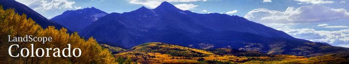
Colorado Wildlife Action Plan
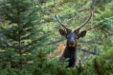
© Mac Stone Colorado State Wildlife Action Plan Featured Image
In order to direct limited conservation resources toward the greatest need for Colorado's wildlife, the Colorado Division of Wildlife developed the Colorado Wildlife Action Plan. This Plan, prepared through a rigorous process of coordination with partners and stakeholders, identifies conservation priorities on three levels: habitats, watersheds, and focus areas.
Priority Habitats
In developing Colorado’s State Wildlife Action Plan (SWAP), CDOW biologists identified those habitats within the state that warrant a higher sense of conservation urgency. The High Priority Habitats map depicts those habitats as represented by Southwest Regional GAP (SWReGAP) landcover classes. Once the SWAP high priority habitats were identified by biologists from CDOW, these habitats were then crosswalked to their equivalent SWReGAP ecological systems, and these systems were extracted from the landcover dataset to produce the High Priority Habitats map. The State Wildlife Action Plan’s (SWAPs) high priority habitats data help users understand which habitats in the state warrant a higher sense of conservation urgency. These habitats are of conservation concern because they are declining in extent or condition, threats are high, and/or they support species of greatest conservation concern.
Priority Watersheds
High Priority Watersheds data depict general patterns of distribution and concentration for the 19 fish species identified as Tier 1 Species of Greatest Conservation Need in Colorado’s State Wildlife Action Plan. These data were derived from CDOW’s aquatic species database, which includes information from CDOW field personnel, field observations, creel surveys, sampling, and other non-CDOW sources (U.S. Fish and Wildlife Service, Bureau of Land Management, and U.S. Forest Service). The areas displayed within this dataset do not cover all critical aquatic waters within the state. Rather, they represent species richness based on general occurrence and distribution of Tier 1 fish species per USGS National Hydrological Dataset (NHD) broken up by HUC units at level 10. This dataset represents the best available, publically distributable data for these species at this time. The fish species represented by this dataset are: Arkansas darter, bonytail chub, brassy minnow, Colorado pikeminnow, Colorado River cutthroat trout, common shiner, greenback cutthroat trout, humpback chub, lake chub, northern redbelly dace, plains minnow, plains orangethroat darter, razorback sucker, Rio Grande chub, Rio Grande cutthroat trout, Rio Grande sucker, roundtail chub, southern redbelly dace, suckermouth minnow. The State Wildlife Action Plan’s High Priority Watersheds data help users understand which watersheds in the state warrant a higher sense of conservation urgency. These watersheds are of conservation concern because they support the most at-risk fish species in the state. Several of these species are federally listed.
Priority Habitats within Private Lands Focus Areas
The “Priority Habitats within Private Lands Focus Areas” data depict areas containing high priority habitats identified in Colorado’s State Wildlife Action Plan as they occur within private lands focus areas. This data layer represents the Tier 1 priority habitats in Colorado as defined in the Colorado Wildlife Action Plan (http://wildlife.state.co.us/WildlifeSpecies/ColoradoWildlifeActionPlan/ ). The habitats depicted have been constrained in GIS to areas in the State that have been identified as focus areas for land protection programs by CDOW and The Nature Conservancy, and further constrained to those areas that fall on Private Land (see http://www.nrel.colostate.edu/projects/comap/). The original land cover data were derived from the Southwest Regional Gap (SWReGap) project. This dataset was created to help guide land acquisition and habitat management and protection efforts by the Colorado Division of Wildlife and wildlife conservation collaborators.


Contribute to LandScope

Want to join, work with us or simply find out more? Learn how you can get involved.
