

Wildlife Habitat Benefits Toolkit
A Bold Effort by Mike McQueen
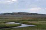
© Edward Chin/Shutterstock shutterstock_2409298
What’s the value of any parcel of land in its natural and undeveloped state? That’s long been one of the thorniest questions in land conservation.
To date, much more work has gone into calculating potential land values after development. Commercial developers can tap a wealth of data as they size lots and houses and scale amenities to maximize profits from producing new neighborhoods. They’re quick to share these numbers with local planning boards and public officials, too, to show the returns their projects will generate in jobs and property taxes.
What’s been missing is the other side of equation: the value of leaving the land in its natural state. And it’s been difficult to demonstrate how land might be better left undeveloped. What’s a forest, wetland, or open space worth? Or a scenic view? Or habitat for rare plants and animals? Or a day of fishing, hunting, or bird-watching? Without such estimates, it’s a challenge for land trusts, local governments, state agencies, or planners to decide what land to protect and what to develop.
For the past 20 years, a growing body of research into ecosystem services has attempted to answer such questions. Until recently, these individual studies have been narrow in scope, mostly examining one specific parcel or a single conservation value like hunting, fishing, or habitat in isolation. But now three researchers have assembled data from this disparate research into a comprehensive and easy-to-use toolkit that can help quantify the seemingly unmeasurable value of undeveloped lands.
Providing Value
The Wildlife Habitat Benefits Toolkit released by Defenders of Wildlife provides a first step for people who want to create defensible estimates of the economic value of undeveloped land.
The release of the Toolkit follows a 22-month review of hundreds of studies about the local economic impacts of open space, wetlands, and hunting and fishing by Timm Kroeger and Frank Casey of Defenders' Conservation Economics Program and John Loomis of Colorado State University. Drawing upon this mountain of data, they developed models that incorporate all those valuation estimates, making it possible to assess the overall economic worth of a specific undeveloped parcel anywhere in the United States. Users of the Toolkit can now generate estimated values for their areas of interest, and its results can be applied as easily to ranchlands in Montana as to Florida wetlands.
Assembling the Toolkit
The free, downloadable Toolkit includes an introduction, two technical reports and user manuals, spreadsheets showing value and visitor use estimation models, and a summary of the results generated from the different models and tables. Its users can generate value estimates by entering a few key characteristics about a parcel, like land cover type and acreage. They also can locate specific studies for similar areas included in the Toolkit's databases.
The Toolkit assembles and in some cases updates previous models for estimating the economic value of wetlands, aquatic habitat improvements, terrestrial habitats, salmon and other threatened, endangered, and rare species. In addition, the Toolkit provides new models for open space-related property value premiums and wildlife-associated visitation. A key feature allows users to estimate effects not captured in traditional recreation spending-based analyses that focus solely on the market impacts of recreation.
The toolkit comprises a handful of key models to generate the economic value of a site, and users can filter results based on individual models or generate results for all of them.
- The open-space property-value premium estimator measures the increased returns that residential property owners receive from nearby natural areas.
- The wildlife activity day-value model computes the benefits that participants in wildlife-associated recreation activities receive as a result of their direct interaction with wildlife and their habitats.
- The terrestrial, aquatic, andwetland value models generate estimates of the value of the ecosystem services supplied by these lands.
- The threatened, endangered, or rare species and salmon models produce estimates of individuals’ willingness to pay for increases in the population of rare, threatened, or endangered species or preventing declines in species populations.
The researchers emphasize that the estimates in most cases represent minimum values because of data gaps for values associated with carbon sequestration, water supply, air and water quality services, crop pollination, and outdoor recreation that is not primarily wildlife-related, as well as the avoided cost of community services. These values are not covered by the toolkit because they couldn’t be quantified or put into a workable, accurate model. Some of the values, particularly carbon sequestration, may be incorporated into the toolkit in the future.
The Doris Duke Charitable Foundation provided funding for the development of the toolkit through the Wildlife Habitat Policy Research Program of the National Council for Science and the Environment.
Go to the Map

Use the interactive map to zoom smoothly from a national view to state and local perspectives anywhere across the country.