

 © Louis Vest (LandScope Texas Banner)
Recreational Paddling Trails
Overview
This data layer symbolizes paddling trails located throughout Texas’ coastal and inland waters.
Data Layer Description
Source

Texas Parks and Wildlife Department (TPWD)
Location
Texas
Description
This 2012 updated dataset represents a visual for the public to use to located outdoor paddling trails. The Texas Paddling Trails is a program to develop public inland and coastal paddling trails throughout the state. The trails support fishing and wildlife-viewing information and more. These trails provide well-mapped accessible day trips in a variety of settings and for all levels of paddling experience. Digitized by TPWD.
How to get the data layer
Contact the TPWD GIS Lab Manager, Kim Ludeke.
How you might make use of this data layer
This dataset is beneficial in that it provides recreational value for the public within each regional division in Texas.
How to get more information
Visit the TPWD Texas Paddling Trail website.
Access and use constraints
Attribution Non-Commercial (BY-NC) This license lets others remix, tweak, and build upon our work non-commercially, and although their new works must also acknowledge us and be non-commercial, they do not have to license their derivative works on the same terms. (http://creativecommons.Org/licenses/by-nc/3.0/)
Credits
Texas Parks and Wildlife Department. 2012.
Sample Map
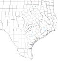
© Texas Parks and Wildlife Department Recreational Paddling Trails

