

 © Louis Vest (LandScope Texas Banner)
Public Beach Access
Overview
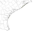
Public beach access points along the Texas Gulf Coast.
Data Layer Description
Source

Texas General Land Office (TGLO)
Location
Texas Gulf Coast
Description
Locations for public beach access along the Texas Gulf Coast. The data was created in 1996 and updated in 2008. Represents public access points to bays and Gulf beaches in Texas coastal counties. Data collected by the Texas General Land Office in cooperation with coastal municipal and county governments. Locations may be inexact.
How to get the data layer
This data can be found on the TGLO's GIS Lab's website.
How you might make use of this data layer
This dataset will provide the public with a means to find a way in to public beaches.
How to get more information
The TGLO’s Online Map Viewer.
Credits
Texas General Land Office. 2008.
Sample Map
© Texas General Land Office Public Beach Acess

