

 © Pete Saloutos/Panoramic Images (Washington Title Image Large)
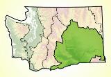
Columbia Plateau Landforms
In Washington, the Columbia Plateau’s landscape ranges from an elevation of 160 feet along the Columbia River to nearly 4,000 feet above sea level in the Badger and Tekoa mountains. Prominent landforms in the ecoregion include the Palouse Hills, the Channeled Scablands, the Pasco Basin, and the Yakima Fold Hills.
Two dramatic events shaped the geology of the Columbia Plateau. First a great flood of lava started 17 million years ago and continued for roughly ten million years. It left the ecoregion covered in basalt—6,000 feet deep in some places.
Layered atop that basaltic bedrock are wind-driven silts and volcanic ash from the Cascades. These formed the rich loess soils of the Palouse region, which can be up to 200 feet thick.
In more recent geologic history—a mere 12,700 years ago—vast floods associated with Glacial Lake Missoula carved out the Channeled Scablands of eastern Washington and sculpted the coulee landscape of today.
For details of this ecoregion within Washington, click a subheading in the left column.
View the more general description of this ecoregion in North America
Loess: Wind-deposited sediments made of silt and renowned for their fertility. >back
Go to the Map

Use the interactive map to zoom smoothly from a national view to state and local perspectives anywhere across the country.