

 © Bruce McNitt/Panoramic Images (Virginia)
Virginia Conservation Lands Database
Overview
The Conservation Lands Database includes properties considered protected through permanent conservation easement and/or through protective management.
Data Layer Description
Source

VA Dept. of Conservation and Recreation, Natural Heritage
What this data layer represents
The Conservation Lands Database includes properties considered protected through permanent conservation easement and/or through protective management.
Location
Virginia
Scale: 1:24,000 or better
Description
DCR began digitally mapping the boundaries for agency owned and managed State Parks and State Natural Area Preserves in 1998. In August of 1999, the Department of Technology Planning designated DCR as the lead agency in developing the Commonwealth’s state-wide Conservation Lands Database. Since this mandate, our database has grown to include state, federal, private, and locally managed lands and conservation easements. We do not track or map Agriculture/Forest Districts and other “term” easements.
How to get the data layer
Visit VA DCNR's downloads page.
How you might make use of this data layer
This database is useful in conservation planning because it shows where existing protected lands are located and who is working to protect them. A user can run statistics, perform spatial analyses against mapped areas of conservation interest, and perform other queries.
How to get more information
Visit VA DCR's Natural Heritage info page.Sample Map
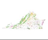
© VA-DCR Natural Heritage VA-Conservation Lands Database

