Pennsylvania DCNR Acquisitions
Overview
This dataset includes lands that have been acquired by land trusts, conservancies and municipalities for the purposes of recreation, critical habitat protection and open spaces with funding from the Pennsylvania Department of Conservation and Natural Resources (DCNR).
Data Layer Description
Source
Pennsylvania Department of Conservation and Natural Resources, Bureau of Conservation and Recreation
What this data layer represents
This dataset includes lands that have been acquired by land trusts, conservancies and municipalities for the purposes of recreation, critical habitat protection and open spaces with funding from the Pennsylvania Department of Conservation and Natural Resources.
Location
a) Pennsylvania
b) 1:24,000
Description
This layer was created by the DCNR Bureau of Recreation and Conservation to track the lands acquired for conservation and recreation with funds from the Community Conservation Partnerships Program. This grant program combines a number of funding sources to assist local governments and non-profits in their efforts to conserve land in their communities.
How to get the data layer
More information and an interactive map of DCNR Grant acquisition and development projects can be found at http://www.gis.dcnr.state.pa.us/brc/grantprojectsmap.html.
How you might make use of this data layer
The DCNR acquisitions layer identifies lands that have already been acquired for protection.
How to get more information
More information on Department of Conservation and Natural Resources conservation projects and grants can be found at http://www.dcnr.state.pa.us/brc/conservation/index.htm.
More information on the Community Conservation Partnership Program grants can be found here http://www.dcnr.state.pa.us/brc/grants/index.aspx.
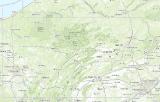
Sample Map