

Blue Infrastructure
Overview
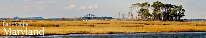
The Blue Infrastructure study area and extent of inventory data was defined as the 16 coastal zone counties (Anne Arundel, Baltimore, Calvert, Caroline, Cecil, Charles, Dorchester, Harford, Kent, Prince George's, Queen Anne's, Somerset, St. Mary's, Talbot, Wicomico, and Worcester) and Baltimore City. Including Baltimore City makes a total of 17 designated locations based on sixteen County Boundaries and one City Boundary. Four main models were created to perform the overlay processes to calculate the Zonal Majority used to determine the total rank for all the segments. The Blue Infrastructure assessment was designed as a spatial evaluation of coastal habitat, critical natural resources and associated human uses in the tidal waters and near-shore areas of Maryland's coastal zone. The Assessment is used to identify near-shore tidal habitat priority areas that support coastal habitats and the resources and economies that depend upon them. The Blue Infrastructure was developed through a partnership between the Maryland Department of Natural Resources' Chesapeake and Coastal Program, the National Oceanic and Atmospheric Administration and Towson University's Center for GIS. Last Updated: 5/1/2010
A subset of watersheds created for the Blue Infrastructure Project (BI) based on the DNR 12 digit watershes as follows; This file (SWSHED12) is a statewide digital watershed file. It was created primarily for state and federal agency use. The watersheds define Strahler (Strahler 1952 p. 1120) third order stream drainage by contours on U.S. Geological Survey (USGS) 7.5 minute quadrangle map sheets. Some watersheds drainage areas were defined for streams less than third order and some large area watershed were split to maintain a maximum size of 15,000 acres. The watershed boundaries in this file were developed in a joint state and federal effort to create a consistent watershed file for use by all government agencies with an interest in Maryland's watersheds. The U.S. Natural Resources Conservation Service (NRCS) redefined the third order watersheds creating the HUA14 file. This file contains all of the HUA14 watersheds and some added watersheds to maintain water quality sampling sites. It was also used to create the Maryland Sub-Watershed file. Last Updated: 5/1/2010
.
Data Layer Description
Source

Maryland Department of Natural Resources
Location
Maryland
Scale: unknown
Description
The Blue Infrastructure study area and extent of inventory data was defined as the 16 coastal zone counties (Anne Arundel, Baltimore, Calvert, Caroline, Cecil, Charles, Dorchester, Harford, Kent, Prince George's, Queen Anne's, Somerset, St. Mary's, Talbot, Wicomico, and Worcester) and Baltimore City. Including Baltimore City makes a total of 17 designated locations based on sixteen County Boundaries and one City Boundary. Four main models were created to perform the overlay processes to calculate the Zonal Majority used to determine the total rank for all the segments. The Blue Infrastructure assessment was designed as a spatial evaluation of coastal habitat, critical natural resources and associated human uses in the tidal waters and near-shore areas of Maryland's coastal zone. The Assessment is used to identify near-shore tidal habitat priority areas that support coastal habitats and the resources and economies that depend upon them. The Blue Infrastructure was developed through a partnership between the Maryland Department of Natural Resources' Chesapeake and Coastal Program, the National Oceanic and Atmospheric Administration and Towson University's Center for GIS. Last Updated: 5/1/2010
A subset of watersheds created for the Blue Infrastructure Project (BI) based on the DNR 12 digit watershes as follows; This file (SWSHED12) is a statewide digital watershed file. It was created primarily for state and federal agency use. The watersheds define Strahler (Strahler 1952 p. 1120) third order stream drainage by contours on U.S. Geological Survey (USGS) 7.5 minute quadrangle map sheets. Some watersheds drainage areas were defined for streams less than third order and some large area watershed were split to maintain a maximum size of 15,000 acres. The watershed boundaries in this file were developed in a joint state and federal effort to create a consistent watershed file for use by all government agencies with an interest in Maryland's watersheds. The U.S. Natural Resources Conservation Service (NRCS) redefined the third order watersheds creating the HUA14 file. This file contains all of the HUA14 watersheds and some added watersheds to maintain water quality sampling sites. It was also used to create the Maryland Sub-Watershed file. Last Updated: 5/1/2010
How to get the data layer
Contact:
Kevin Coyne
Maryland Department of Natural Resources
Tel: 410-260-8985
How you might make use of this data layer
This data layer Identifies unique shoreline segments (1 Km x 100 m) that support high quality coastal habitat, critical natural resources and associated human uses in tidal waters and near-shore areas.
How to get more information
Visit Maryland DNR's Blue Infrastructure page.
Or contact Catherine McCall
Maryland Department of Natural Resources
Tel:L 410-260-8737
Credits
Maryland Department of Natural Resources

