

Percent Stream Buffer Zone as Natural Land Cover
Overview
This layer describes the amount of natural land cover contained within a buffer area extending 30 meters to each side of all streams contained within the basin (defined as 12-digit HUC areas by the USDA’s Watershed Boundary Dataset (WBD)) and extending out 30 meters from the edge of water bodies such as lakes and ponds that are connected via flow to the streams.
Data Layer Description
Source

U.S. Environmental Protection Agency
Sustainable and Healthy Communities Research Program
Enviroatlas
Location
Conterminous United States
Map Scale: vector inputs - 1:24,000; grid input - 30 meter pixels
Description
Natural land cover adjacent to the stream can help protect our water quality for drinking, for recreation, and to support aquatic habitat for fish and other animals. Natural vegetation can help prevent sediment, nutrients, harmful bacteria, pesticides, and other pollutants from entering our waters. Water quality protection has a cumulative effect in that vegetation at a specific location in a watershed protects the water for onsite use as well as for many additional uses further downstream and even beyond, affecting the quality of our bays and estuaries.
Riparian vegetation can also help regulate the flow of water into a water body by acting as a sponge, allowing runoff to soak into the ground, recharging ground water or being transpired through vegetation. This sponge effect can help mitigate the effects of flooding during large storm events and can help prevent stream bank erosion and downstream property damage.
Natural vegetation can provide habitat for many different wildlife species including those that are important as game species or those that we enjoy just by observing them. Natural vegetation along streams can provide wildlife with critical corridors for moving from one area to another. It also can provide a canopy cover for the water body which can help regulate the temperature of the water protecting the habitat for fishes and other important aquatic life. Again, the benefits of streamside vegetation can extend a long way downstream of the local area.
Natural vegetation, especially forests can also help mitigate air pollutants and store carbon which helps maintain a balance between carbon storage and carbon emissions. For many of us, a stream or lake surrounded by natural vegetation is much more aesthetically pleasing than a stream surrounded by other land uses, and is more likely to be used for recreation purposes.
For each 12-digit HUC area, the percentage of the land area adjacent to streams that is comprised of natural vegetation is provided.
This data layer was created to quantify the amount of natural vegetation along streams for each WBD 12-digit HUC area in the conterminous United States and to be used in the Sustainable and Healthy Communities Research Program. The metric was generated using the ATtILA tool in conjunction with the 2006 National Land Cover Data (NLCD) and the National Hydrography Data (NHD) high resolution (1:24,000 or higher) stream lines and water bodies. A stream buffer was generated by evaluating the land cover composition of the area contained within one 30 m x 30 m grid cell of a water body. Isolated water bodies (i.e., those that are not hydrologically connected) were not included in the analysis. Natural land cover was defined as NLCD classes 31, 41, 42, 43, 52, 71, 90, and 95. For more information on the metric calculation, please see the ATtILA User's Manual.
How to get more information
Methodology:
Jones, K. Bruce; Riitters, Kurt H.; Wickham, James D.; Tankersley, Roger D., Jr.; O'Neill, Robert V.; Chaloud, Deborah J.; Smith, Elizabeth R.; Neale, Anne C. 1997. An Ecological Assessment of the United States Mid-Atlantic Region: A Landscape Atlas. United States Environmental Protection Agency. Office of Research and Development, Washington DC, 20460. EPA/600/R-97/130.
Software:
Wade, Timothy. G. and Donald. W. Ebert. 2005. Analytical Tools Interface for Landscape Assessments (ATTILA) User Manual. U.S. Environmental Protection Agency, Washington, DC, EPA/600/R-04/083. (http://www.epa.gov/esd/land-sci/attila)
Data:
Visit:
http://www.mrlc.gov/nlcd_2006.php
http://nhd.usgs.gov/index.html
http://www.nrcs.usda.gov/wps/portal/nrcs/main/national/water/watersheds/dataset
Sample Map
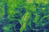
© U.S. Environmental Protection Agency Riparian Integrity by Subwatershed Sample Map

