

Connectivity, Natural Land Cover 2006, Water Ignored
Overview
Using the 2001 National Land Cover Database (NLCD) and its complementary land-cover change data, this national Morphological Spatial Pattern Analysis (MSPA) takes a different approach to mapping of green infrastructure. Based on concepts from mathematical morphology, MSPA can identify hubs and links from a single map rather than GIS overlay of several maps.
Data Layer Description
Source

United States Environmental Protection Agency
Sustainable and Healthy Communities Research Program
Enviroatlas
What this data layer represents
This national Morphological Spatial Pattern Analysis (MSPA) map identifies hubs and links from a single map (rather than GIS overlay of several maps) and reclassifies NLCD and land-cover change data to bring forests and wetlands into the foreground as features of interest.
Location
Conterminous United States. Scale: grid input – 30 meter pixels.
Description
This national Morphological Spatial Pattern Analysis (MSPA) is based on concepts from mathematical morphology, which can be used to identify hubs and links from a single map rather than GIS overlay of several maps.
This map reclassifies NLCD and land-cover change data into foreground and background features.
While the choice of elements to include in green infrastructure can be wide-ranging, our features of interest were forest and wetlands, which could be complemented with additional information. Water was not included as a foreground class because it is impractical to distinguish agricultural waste ponds and other man-made waterbodies from rivers and lakes for all of the conterminous United States in a reliable and efficient manner. In additional, rivers, lakes, and other natural waters both promote and hinder movement of biota.
A series of image processing routines then reclassified the binary foreground features into the following classes:
- Core: Foreground pixels surrounded on all sides by foreground pixels; in the terminology of green infrastructure, core is equivalent to hub.
- Islet: Foreground pixels that do not contain core.
- Bridge: Foreground pixels that connect two or more disjunct areas of core.
- Loop: Foreground pixels that connect an area of core to itself.
- Branch: Foreground pixels that extend from an area of core, but do not connect to another area of core.
- Edge: Pixels that form the transition zone between foreground and background.
- Perforation: Pixels that form the transition zone between foreground and background for interior regions of foreground. Consider a group of foreground pixels in the shape of a doughnut. The pixels forming the inner edge would be classified as perforations, whereas those forming the outer edge would be classified as edge.
The rules for distinguishing between foreground and background were applied equally to the NLCD 1992 component of the NLCD 2001 land-cover database. The change analysis focused on the transitions between bridge and background and core and background. We focused on bridge and core because these two classes are the main components of green infrastructure.
We further restricted our focus to change from and to background because these transitions represent forest and wetland gain and loss. Most of the other changes that could be summarized in a change matrix arise from neighborhood effects. For example, conversion of forest edge to non-forest also changes neighboring core forest to edge forest. We summarized changes from background to bridge or core and vice versa using a 120x120 km grid covering the conterminous United States. Loss of bridge is only a potential loss of connectivity because two areas of core may be connected by more than one bridge.
How to get the data layer
How you might make use of this data layer
This MSPA uses the 2001 National Land Cover Database (NLCD) and its complementary land-cover change data to add context lost when political boundaries are imposed on green infrastructure analyses.
How to get more information
Annie C. Neale
Physical Scientist
Environmental Protection Agency
Office of Research and Development
Sustainable and Healthy Communities Research Program
Research Triangle Park, NC 27711
919-541-3832
Sample Map
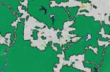
© U.S. Environmental Protection Agency Green Infrastructure Connectivity Sample Map

