
Land Trusts and Conservation Groups
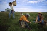
© LYNN JOHNSON Land Trusts and Conservation Groups Featured Image
Through a series of surveys, workshops, presentations and one-on-one conversations over the past two years, we’ve reached out to land trusts and other partners to learn about the resources and tools you need that can help you do your work better. Thank you to the hundreds of land trust representatives who have provided input and feedback. Through LandScope America, land trusts and conservation groups can:
- Use simple online GIS tools to create, share, and print maps of your existing or planned conservation projects.
Tip: Look for the Draw tools in the top right of the map viewer.
- View multiple sets of conservation priorities developed by different public and private groups through a single map view. See how State Wildlife Action Plans, natural heritage program priority areas, Nature Conservancy ecoregional priorities, and regional greenprints relate to each other.
Tip: Select the Conservation Priorities theme at the top left of the map viewer.
- View detailed current aerial photography of your region.
Tip: Select the Satellite base map. Type your zip code or address into the Find box.
- Find valuable environmental data about your area or your state, served up from many credible sources, both public and private.
Tip: Select the Threats or Plants and Animals theme at the top left of the map viewer.
- Share your organization’s conservation vision with policy makers, partners, and local supporters.
Tip: Build an organizational profile for your group.
- Use the website as an outreach tool to build local constituencies and support for your organization’s conservation vision.
Tip: Create a link from your organization’s home page to a map view of your service area on LandScope America.
- Connect with landowners who are looking for a land trust in their area.
Tip: use the Find a Land Trust page.
Suggested Content to Explore Next
- Find your state’s home page.
- Read Identify Priority Places: A Practitioner’s Guide.
- View options for conservation financing.
- Read a fascinating piece about parks and protected areas.
- Learn about your ecoregion.
Sign in to your account
Sign in with your username and password
Don't have an account?
Creating your LandScope profile is fast, free, and simple.

Go to the Map

Use the interactive map to zoom smoothly from a national view to state and local perspectives anywhere across the country.
Go Straight to Your State
Learn about conservation and open space in your state.