

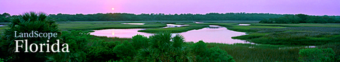
 © Steve Vaughn/Panoramic Images (Florida Title Image Large)
Corridors in Florida
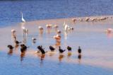
© Ivan Cholakov/Shutterstock Corridors in Florida Featured Image
Ecological corridors serve as pathways for dispersal, migration and the exchange of genes necessary to maintain viable populations of plants and animals. They also facilitate ecosystem processes such as natural fires and hydrological regimes. The Florida peninsula functions as a global migration corridor for songbirds, linking breeding sites in North America with wintering areas in the Caribbean, Central and South America. Broad forested floodplains associated with alluvial rivers in the Florida panhandle provide nutrients, shelter, and thermal regulation critical to both the aquatic and terrestrial environments. These corridors also serve to buffer streams from sediments and pollutants and support high species diversity. Large landscape linkages are especially important for wide-ranging species, such as Florida panther and Florida black bear that need large areas to ensure long-term population viability.
Human land use has resulted in the loss and fragmentation of once extensive ecological corridors, increasing the conservation importance of remaining functional linkages. In Florida these important corridors include the lands linking Ocala National Forest in Marion and Lake Counties to Osceola National Forest which borders the Okefenokee Swamp National Wildlife Refuge in south Georgia; a extensive corridor in the panhandle linking the Apalachicola National Forest to Eglin Air Force Base and Blackwater River State Forest; lands linking Everglades National Park to lands north of the Caloosahatchee River provide an important dispersal corridor for the Florida panther; and lands linking the dry prairies of Avon Park Air Force Range and Kissimmee Prairie State Preserve in Highlands and Okeechobee Counties with lands adjacent to the St. Johns River in Volusia County. The Florida Ecological Greenways Network identifies these corridors as ‘critical linkages.’
Explore Florida’s Corridors:
The Ecological Greenways Network
The Ecological Greenways Network is a statewide system of landscape hubs, linkages, and conservation corridors that was developed by the University of Florida using a GIS decision support model. Ecological Network connects and integrates existing conservation areas with unprotected areas of high ecological significance. These areas are prioritized based on factors such as the needs of wide-ranging species, importance for statewide connectedness and importance of riparian corridors.
Click here for more information on Ecological Greenways.
Florida Trails Network
This interactive website supports the vision of the Office of Greenways and Trails to develop a statewide connected system of greenways and trails. Through this website, trail planners and users can view existing trails data and trails prioritization maps, submit GIS data for existing trails, give input on trail opportunities, and submit information for the Recreational Trails Program (RTP).
Go to the Map

Use the interactive map to zoom smoothly from a national view to state and local perspectives anywhere across the country.
Go Straight to Your State
Learn about conservation and open space in your state.
Contribute to LandScope

Want to join, work with us or simply find out more? Learn how you can get involved.
