 © Steve Vaughn/Panoramic Images (Florida Title Image Large)
Florida Forever BOT Projects
Overview
This data layer contains the site-based boundaries of all Florida Forever BOT projects approved by the State's Acquisition and Restoration Council. These lands have been proposed for acquisition because of outstanding natural resources, opportunity for natural resource-based recreation, or historical and archaeological resources.
Data Layer Description
Source
Florida Natural Areas Inventory
What this data layer represents
This data layer contains the boundaries of the Florida Forever Board of Trustees (BOT) environmental land acquisition projects.
Location
Florida
Scale: Various
Description
This data layer contains the site-based boundaries of all Florida Forever BOT projects approved by the State's Acquisition and Restoration Council. These lands have been proposed for acquisition because of outstanding natural resources, opportunity for natural resource-based recreation, or historical and archaeological resources. However, these areas may not be currently managed for their resource value. Portions of these projects may have already been acquired by the State and/or its acquisition partners. Acquired parcels are incorporated into the Florida Natural Areas Inventory's Florida Managed Areas (FLMA) data layer, either as new managed areas (i.e., conservation lands) or additions to existing managed areas.
How to get the data layer
Visit the Florida Natural Areas Inventory's GIS data page.
How you might make use of this data layer
Florida Forever BOT projects can be used to identify areas with outstanding natural resources, opportunity for natural resource-based recreation, or historical and archaeological resources.
How to get more information
Visit the Florida Natural Areas Inventory's GIS data page.
For more information about this program, visit Florida Forever's website.
Access and use constraints
 Attribution Non-Commercial No Derivatives (BY-NC-ND)
Credits
Florida Natural Areas Inventory, December 2012
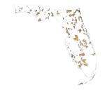
Sample Map