

Corridor Design
Corridor Design
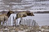
© Richard Seeley | richardseeleyphotography.com | Flying Elk
In order for populations to persist, their habitat patches need to connect to each other. But how do corridor stakeholders effectively establish, conserve, and enhance these connections?
The process of corridor identification and protection is complex. Stakeholders must ask questions such as: Which species “get” connections through these choices and how can we predict what they are thinking? And who gets a say in these decisions?
Recent research suggests that the success of corridors varies. The overview below outlines the steps practitioners use to start answering fundamental questions of corridor design.
Where to Start
1. Gather the Stakeholders
Many factors influence the success of a corridor project, and not all rely on science. Corridors cross federal, state, tribal, and private lands, all with differing resource management systems and objectives.
By fostering collaboration between all the stakeholders, corridor designers can maximize the project’s financial resources, enhance its scientific accuracy, and boost its ability to protect land through conservation easements or acquisition. Collaborations provide a sense of project ownership among the partners, ultimately making the process easier.
2. Prioritize Linkages
In order to prioritize which areas to focus on to establish and maintain effective corridors, stakeholders need to assess the benefits and drawbacks of the options available to them. For example, a valley floor may host several potential crossing zones for a given species, but limited conservation resources may mean that only one area can be prioritized.
Stakeholders must start with questions like:
What is the availability of lands to be conserved in the area?
What are the sizes of the wildland blocks to be connected?
What is the restoration potential within the linkage areas?
With answers in hand, stakeholders can begin to identify areas worthy of attention and begin detailed assessments.
3. Select Focal Species
Corridors frequently focus on a particular species, and large carnivores often draw the most attention because they play an influential role in ecosystem function and the greatest need to move across landscapes.
But from the perspective of effective corridor conservation, not all focal animals are equally important. Some important considerations in selecting focal species include:
Some are more likely than others to disappear once the landscape is fragmented
Some may require continuous habitat, while others may tolerate breaks in habitat
Some play bigger roles in ecosystem processes than others
Some act as “umbrella species,” in that their conservation affords conservation to many other species
Some are naturally bold and pioneering, while others are timid and reclusive
So how do stakeholders determine which species to concentrate on? The most common approach is a more holistic one: choosing a representative suite of several species whose combined corridors will produce a linkage zone with the most connectivity for the species that need it most.
4. Make Models
Computer models help reduce the complexity of the real world to a handful of manageable variables. Such models are extremely helpful for mapping and testing corridor locations, but they are imprecise and must be combined with verified on-the-ground data.
The most common modeling approach relies on a Geographic Information System, or GIS, to map a path that supports the given species’ movements across the land and minimizes the resistance they face. This model, called the least-cost path, divides the world into many small pixels , perhaps 10 meters by 10 meters, and assigns each pixel an overall value based on variables related to specific species needs. For example, the model may score pixels based on how much canopy cover it holds, the quality of its habitat, or how many roads cross it. A map of these value-ranked pixels and surrounding land will show patterns that suggest viable corridor routes.
5. Compile Corridors into Linkage Zones
The least-cost model may highlight many conceivable corridors for each of the focal species. Combining the corridor models for all the various focal species into a single map allows planners and designers to see the area of greatest overlap and adjacency. These areas form the basis of a multi-species linkage zone that becomes the focal area for conservation work. Such linkage zones are preferable to single-species corridors because they provide the greatest conservation bang for the buck.
The Work Begins
After stakeholders have agreed upon and mapped a linkage zone for their chosen focal species, they need to navigate the financial and political landscape. The goal of corridor conservation is to stem habitat degradation within the linkage zone and guide actions toward restoration and protection. This may include purchasing conservation easements, modifying land use patterns [LSA link], and restoring habitat. Developing consensus between multiple landowners and resource managers presents its own new set of challenges, given that the optimal corridor path may connect lands whose owners manage them for markedly different values.